|
Why should you care about it? When you travel through Knox County, you see a variety of things. On one road there are houses. The next road has stores and other businesses. On a third road there are corn fields. The land has been used in different ways on each of these roads. How the land is used is called land development. The local government has passed laws determining which way the land can be used. Laws that explain how the land can be developed are called zoning laws. |
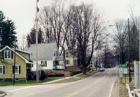 Photo by Mike Shelton |
|
| The government has zoned the first street a residential district. In a residential district people can build houses. |
| The second street is zoned a business district. A business district contains buildings like grocery stores, restaurants, malls and office buildings. |

|
|
| Other buildings like factories, power plants and mills belong in the industrial district. |
| The third street is zoned an agricultural district. In an agricultural district land is used for farming. |

|
|
| Land can also be zoned into a conservation district. In a conservation district, the land is used for parks and golf courses. |
|
| On a sheet of paper, name the five ways in which land can be zoned. |
|
| Now match the buildings from this list to the zoning districts they would be found in: |
- a park
- a house
- McDonalds
- a farm
- a power plant
|
Click on the map to explore zoning in Knox County and Hilliar Township. These maps give an example of how Hilliar Township has decided to develop its land. |
|
|
Click on the handshake to learn about community land develoment plans. Also see how to change rural zoning laws. |
|
|
Click on the notepad to learn what Knox County residents and farmers think about land development and zoning in their community. This class project will challenge you to think about the future of your own community. |
|
| Take the crossroads back to Future of Family Farming. |
|

